For iPhone and Android

Trails, peaks and huts.All in one app.

The mountains, known one step at a time: every trail, every peak, every hut — even where the signal doesn't reach.

What Karn does

Everything you need, from the valley floor to the summit.

Map

A map that knows the trails.

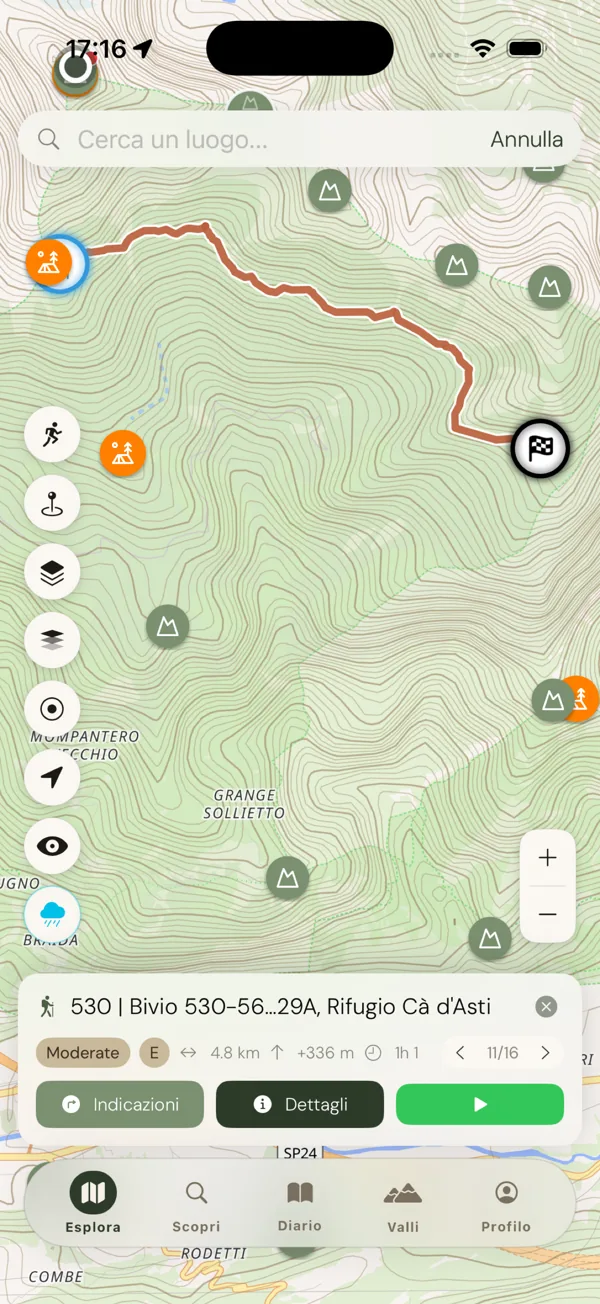
Hiking trails, MTB and cycling routes, via ferratas: the whole network of Italy and the Alps, from CAI, swisstopo and OpenStreetMap data.

  • Search a place and the map takes you there, with trails, peaks and huts in the same results
  • Every trail with distance, ascent, descent and difficulty
  • Via ferratas graded A to E, with what each grade asks of you
  • Terrain in 3D and a precipitation forecast
Profile and water

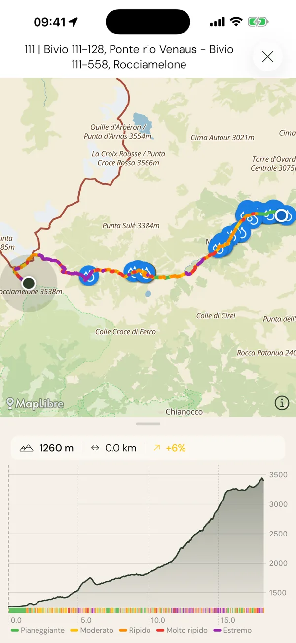
Know what's ahead, metre by metre.

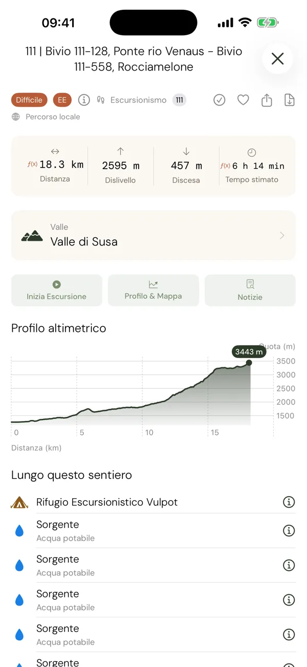
The elevation profile shows every climb and every descent, coloured by gradient. Drag a finger along it and follow the point on the map. Along the way, springs and fountains tell you where to fill your bottle.

  • Profile and map together: slide and see where you'll be
  • Springs, fountains and drinking water along the trail
  • Ask Siri for the nearest water point

Augmented reality

Name the peaks. And the stars.

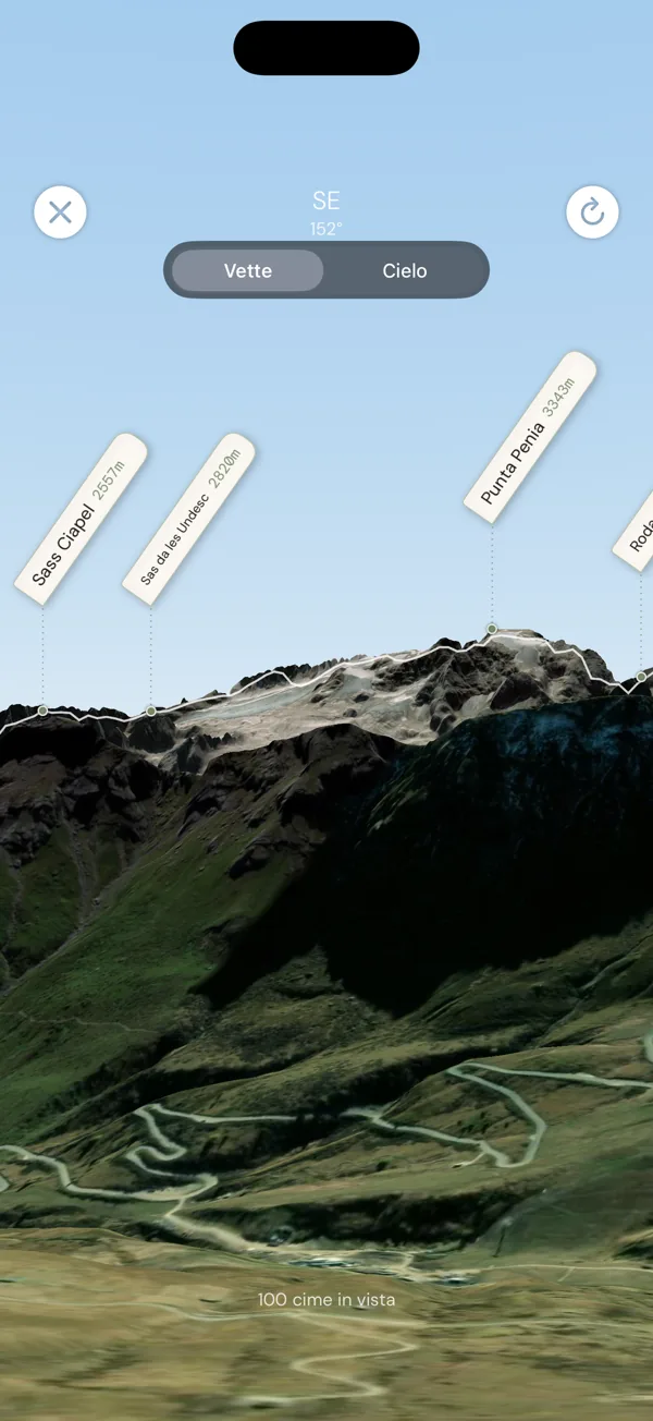
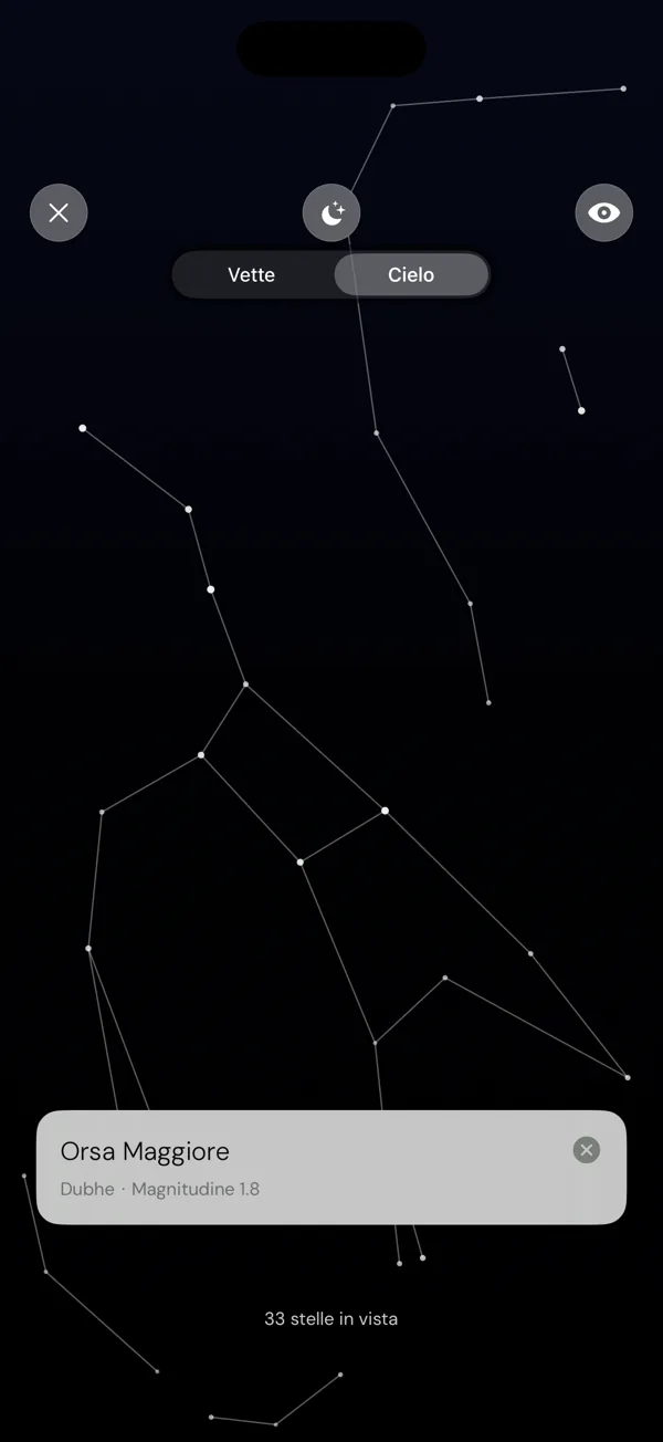
Point your camera at the ridge and every summit appears with its name and altitude. Raise the phone after sunset and the constellations draw themselves across the sky.

  • Peaks recognised from your phone's compass and real elevation data
  • 88 constellations, planetarium view and night vision
  • Works offline, on the ridge as under the stars

The Peak's Book

A book that opens only at the summit.

Like the old summit registers in their metal boxes: every peak has its own, and you can read it and sign it only once you're up there.

  • The notes open only at the summit: from below you just see how many are waiting
  • Read what those who climbed before you wrote, and leave yours — one per peak, signed if you like
  • No coverage up there? Write anyway: the note stays on your phone and posts itself as soon as you have signal again

Valleys

Every valley, its own story.

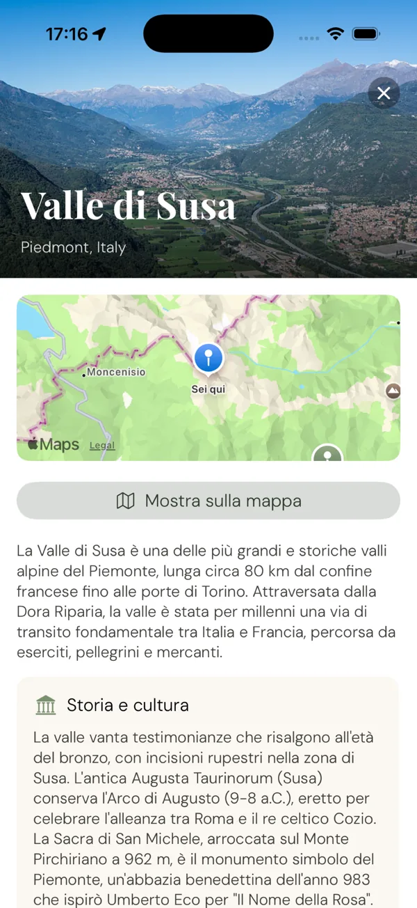
Not just routes: places. Each valley gathers its trails, its huts and its peaks, together with the history that made it what it is.

  • Trails, huts and peaks of the valley in one place
  • History and culture, told for walkers
  • Show it on the map with a tap

Peaks

The summit, before you get there.

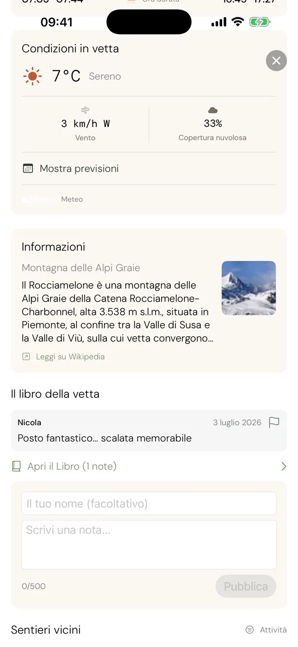
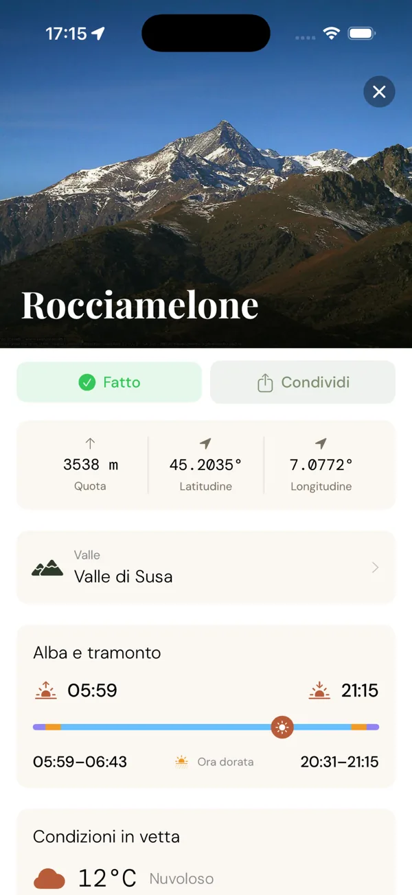
Altitude, position and everything that tells you whether today is the day.

  • Summit conditions: wind, cloud cover, fresh snow, forecast
  • Sunrise and sunset times, with the golden hour
  • Descriptions and photos from Wikipedia

Huts

A place to stop.

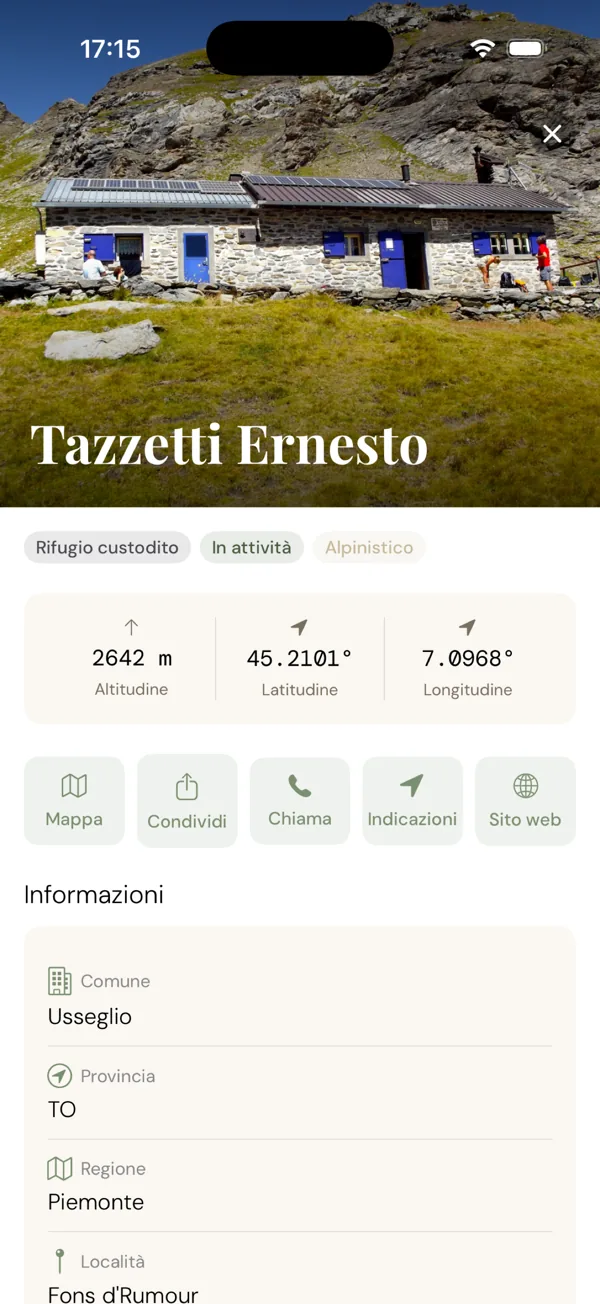
Huts and bivouacs appear right beside the trails that reach them.

  • Whether it's staffed, its altitude, how to reach the keeper
  • Call, get directions or open the website
  • The trails that lead there

Offline

Even with no signal.

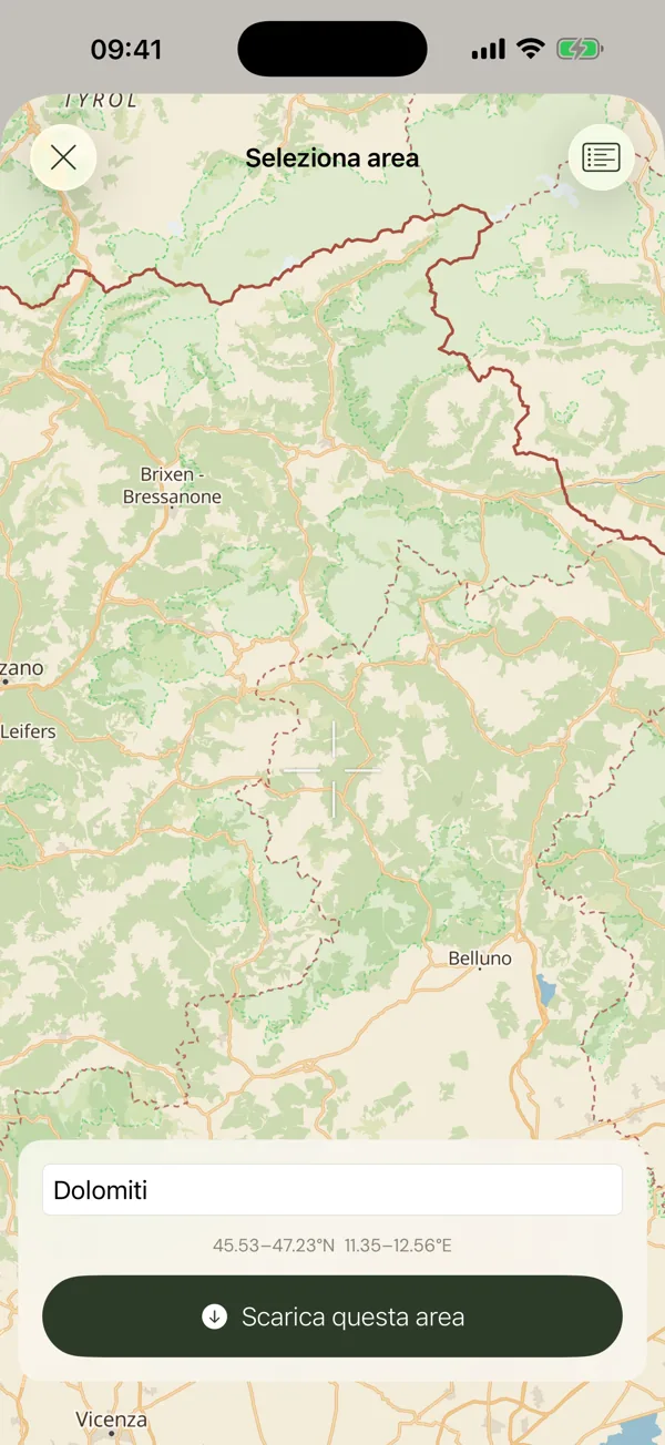
Save a whole area before you leave. Up there, Karn works just as it does down in the valley.

  • Map, trails and 3D terrain of an entire area
  • Peak finder and night sky, fully offline
  • Your hike keeps recording without coverage

Your hikes

Keep the trail you walked.

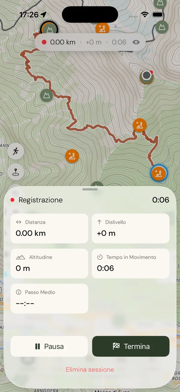
Record a hike and keep it in your diary, with the day's weather and your photos.

  • Distance, ascent and moving time, live as you walk
  • Start recording with Siri
  • A diary of your outings, and a badge for every milestone

And also

  • GPX export

    Take any trail to your watch or another app.

  • Favourites

    Save the trails that matter and find them again in a tap.

  • Four languages

    It follows your phone: Italian, English, French or German.

Built on open data

  • CAI
  • OSM2CAI
  • swisstopo
  • OpenStreetMap
  • GeoNames
  • OpenTopoData

Trails from the CAI trail register and OpenStreetMap, elevations from swisstopo and terrain models: open data, kept alive by the people who actually walk these mountains.

Karn

Free · iPhone & Android

The mountain is waiting.

Name the peaks, get to know the valleys, read the stars above you.

Every step leaves a mark.